Reliable, Accurate Drone Mapping for Construction Projects
Clear communication. On-time scheduling. FAA-licensed and fully insured. Veteran-run and committed to precise, dependable service.
Get a QuoteWhat You Get
A complete visual record of your jobsite—captured accurately and delivered efficiently.
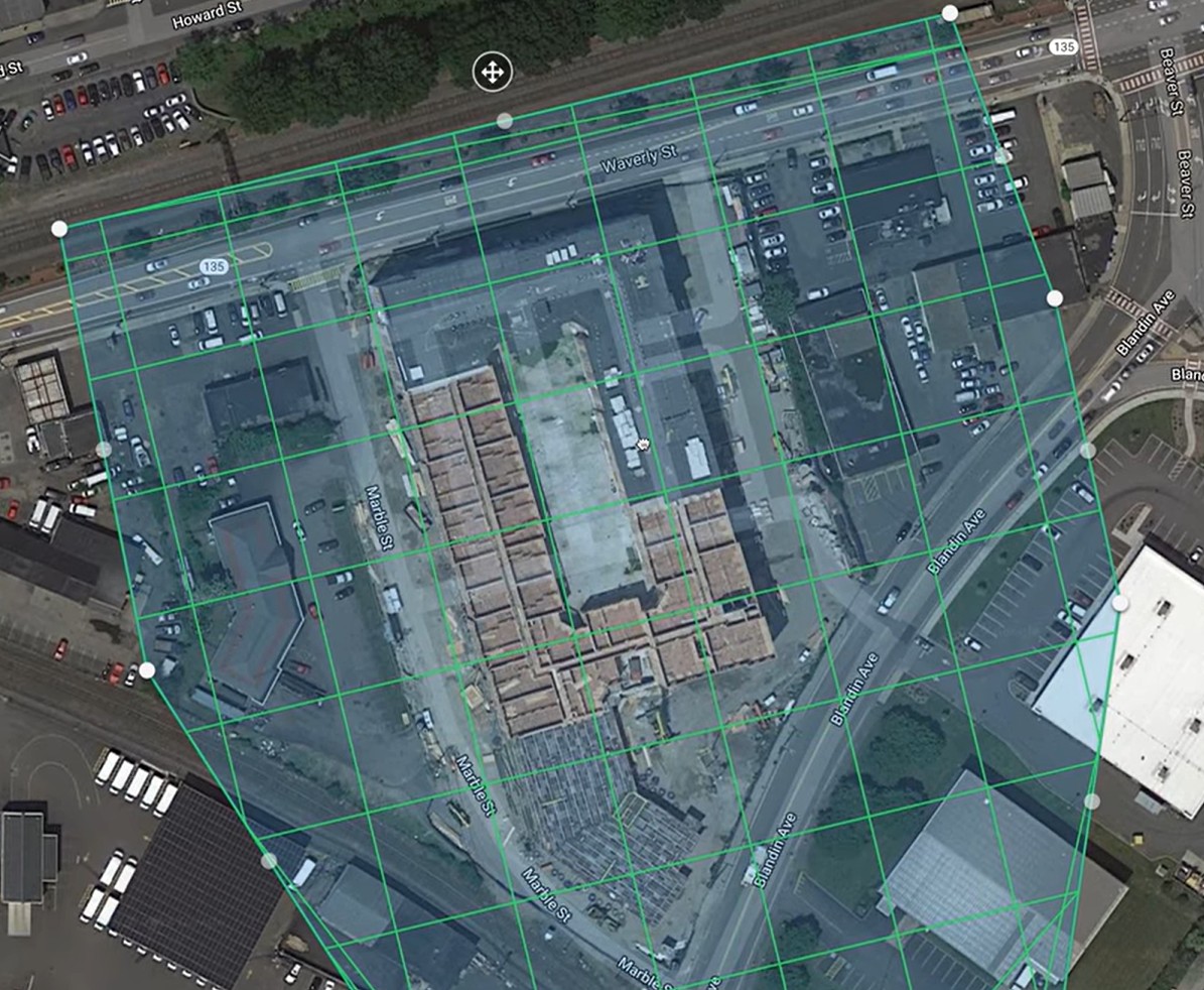
High-Resolution Orthomosaics
Precise top-down imagery stitched from hundreds of photos.
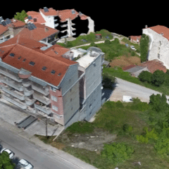
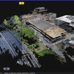
3D Models & Point Clouds
Accessible site geometry for inspections, visualization, and measurement.
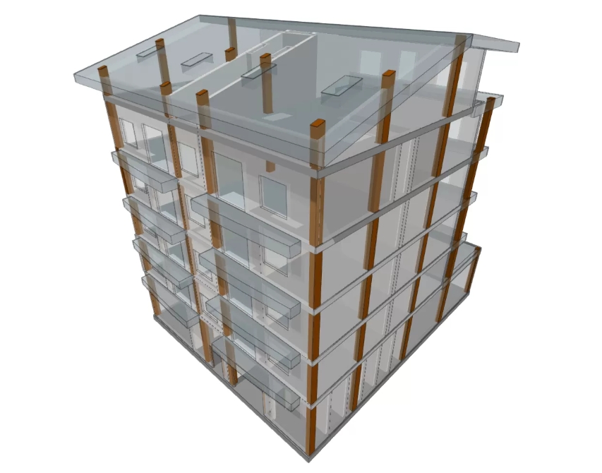
BIM & Design Overlays
Upload IFC, DXF, or PDF plans to check as-built progress against design intent.
Progress Comparisons Over Time
Layer previous orthomosaics or 3D outputs to identify changes, track progress, and spot issues early.
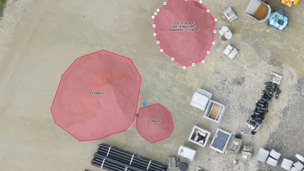
Measurement Tools
Distance, area, volume, and elevation insights in an intuitive cloud interface.
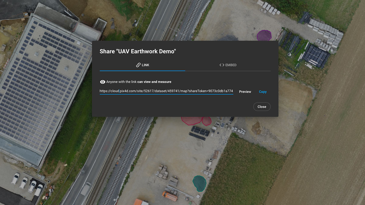
Easy Sharing
Share secure web links with your team, subs, or clients—no software installation required.
Free Hero Shot Marketing Video
Free "Hero shot" marketing video optimized for social media.
Why This Service
Construction teams need consistent, dependable site documentation—not surprises.
This service is built around reliability, transparency, and precision.
Clear communication
Know exactly when flights are scheduled, when data will be ready, and what comes next.
On-time flights
Predictable arrival windows that keep your jobsite running efficiently.
FAA licensed & insured
Safe, compliant operations with commercial liability coverage.
Veteran-run
Disciplined planning, safety, and accountability.
Actionable site intelligence
High-resolution orthomosaics, 3D models, DSMs, and BIM overlays delivered through Pix4Dcloud.
First flight/photos free, with no commitment
Only pay if it adds value.
Intro Offer
Free first flight for construction monitoring projects with three or more scheduled captures.
A simple way to evaluate workflow, communication, and deliverable quality before committing long-term.
FAA-licensed, insured, and veteran-run.
Get a QuoteHow It Works
Schedule Your Flight
Choose a capture window. Receive confirmation and pre-flight communication.
Data Capture
On-time arrival, safety-focused operations, and efficient coverage of the site.
Processing & Delivery
Your orthomosaic, 3D model, and other outputs are processed in Pix4Dcloud.
Review & Share
Access interactive tools, make measurements, compare versions, and share links with your team.
Built on Reliability
Professionalism is the foundation of every project.
FAA Part 107 Licensed
Commercial Liability Insured
Veteran-Run Operation
Clear, Prompt Communication
Reliable, On-Time Scheduling
Get Your Free Instant Quote
No credit card required. Get a detailed quote in minutes.
✓ Free instant quote • ✓ No credit card required • ✓ No obligation
We'll need some basic information to get started.